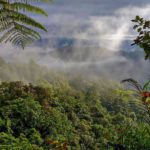
It is another rare day in Quito when I can see mountain peak after mountain peak from my window. It takes me back to our last trip to Cotopaxi National Park when the day started clear and we hurriedly changed plans to take advantage of the excellent weather. Our day still ended in clouds and near rain. We’ve learned never to assume the weather in the Andes and to always be prepared, no matter the weather conditions.
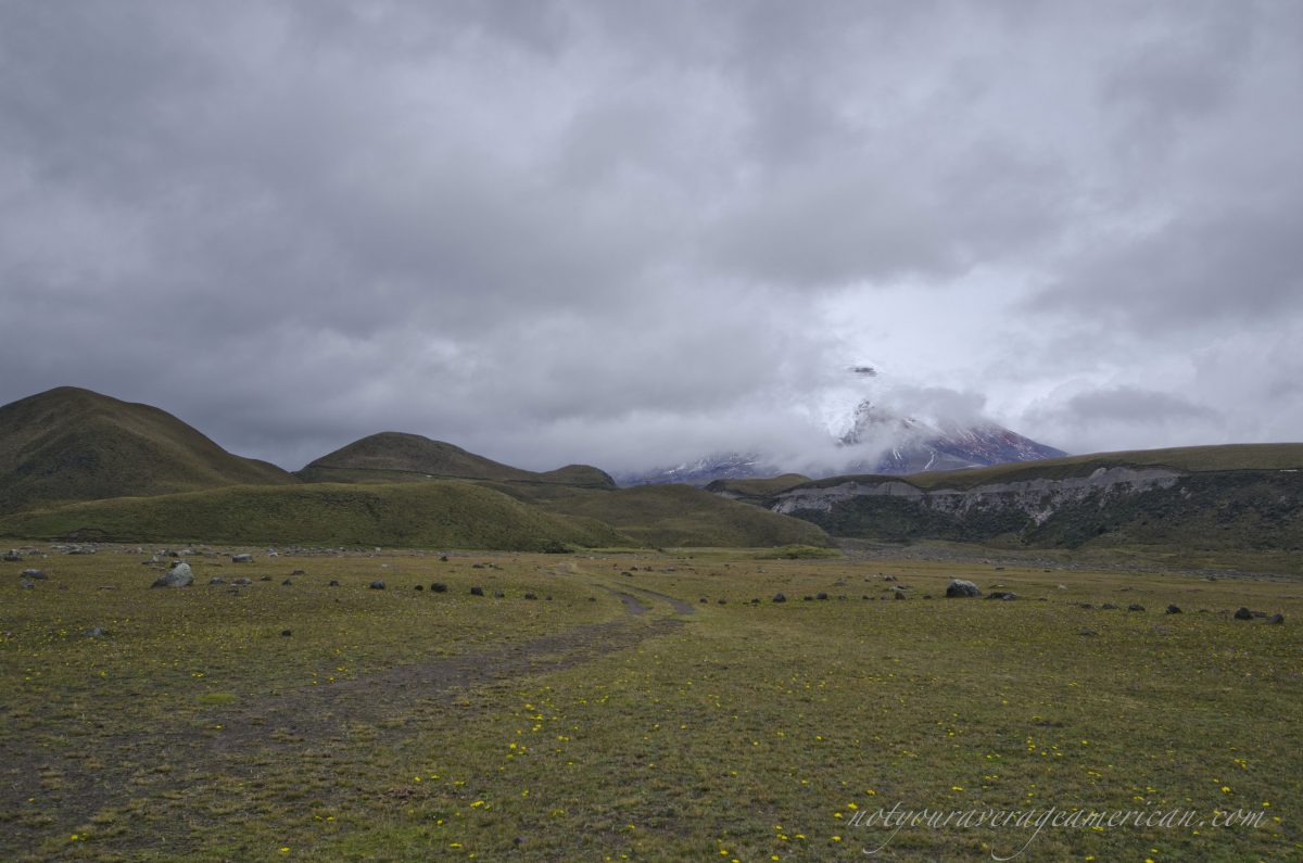
That surprise trip found us exploring the back roads of Cotopaxi National Park. There are several hidden treasures in this area but today I want to introduce you to Pucara Salitre, ancient ruins nestled into the hillsides surrounding the volcano. Although you can find this destination on a map, few tourists ever visit. You need a four wheel drive vehicle or a tour company willing to take the time to show you more than the paved road. A sense of direction doesn’t hurt as the unpaved, dirt roads split again and again and it would be impossible to explore each and every branch of the road. However, a few signs are there to help you and if you keep your eyes open, you should avoid the worst of the trails, some so churned by vehicles the ruts look more like small river valleys. The road least travelled is sometimes the better choice!
Backroads of Cotopaxi National Park
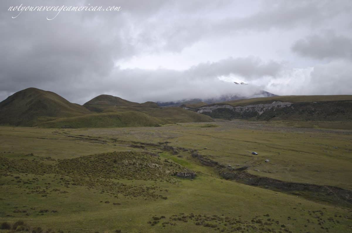
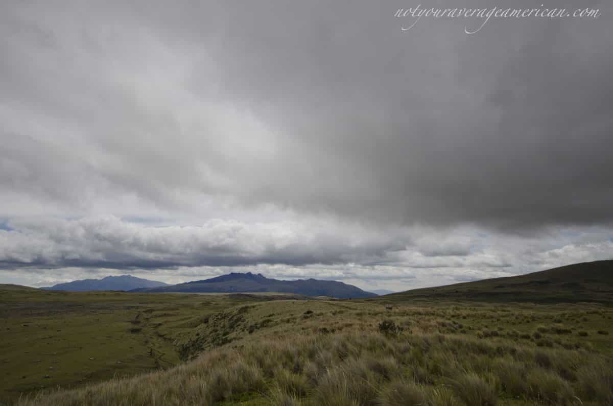
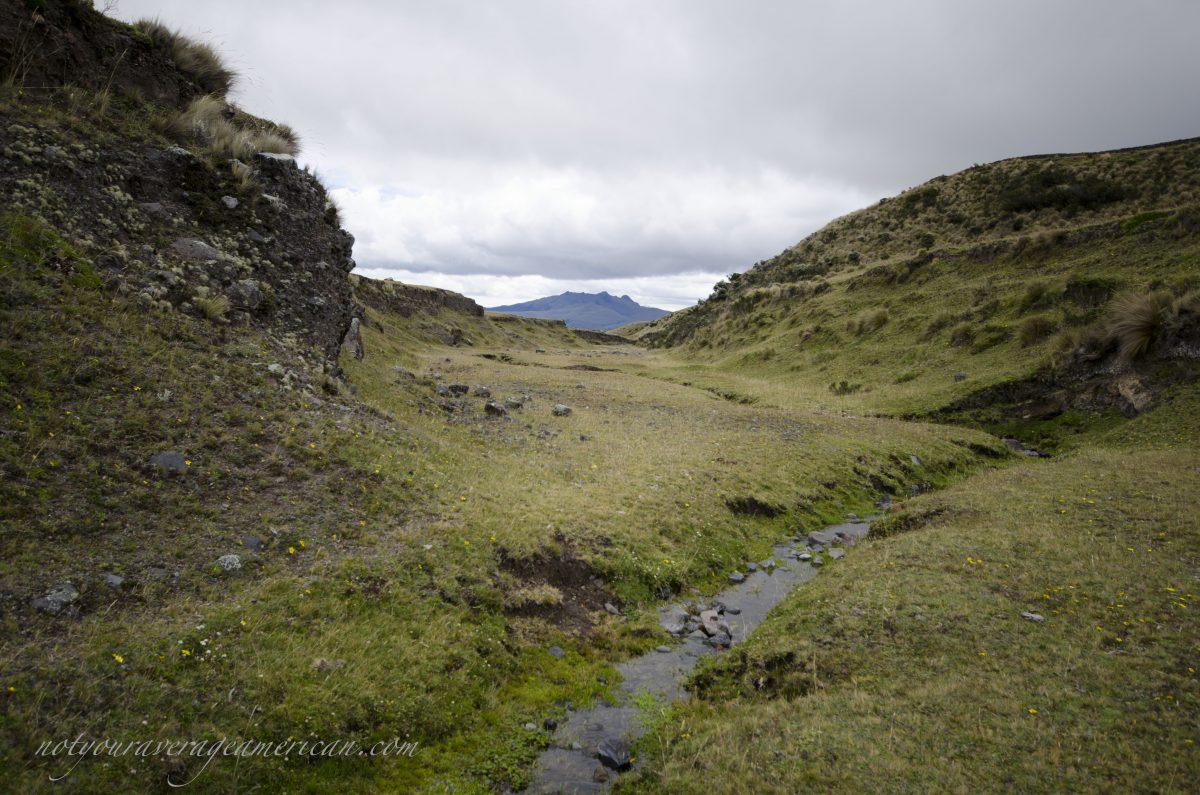
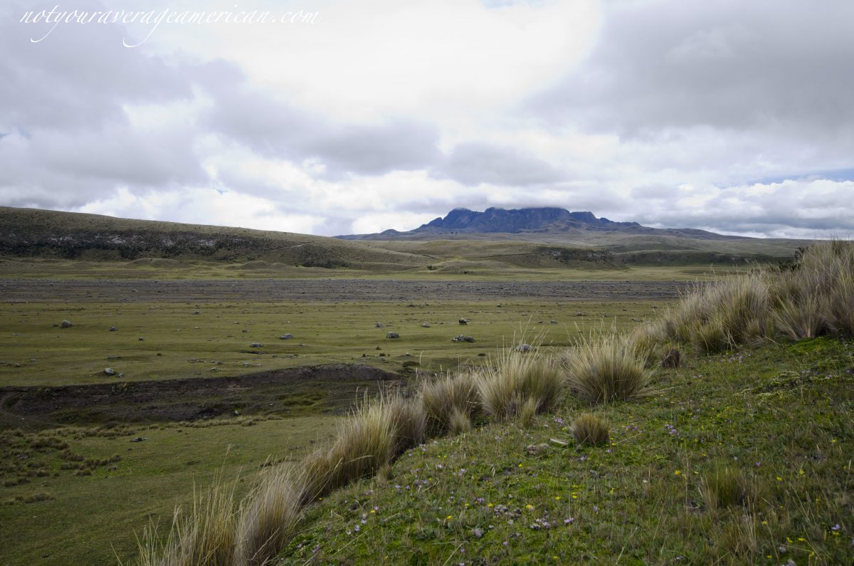
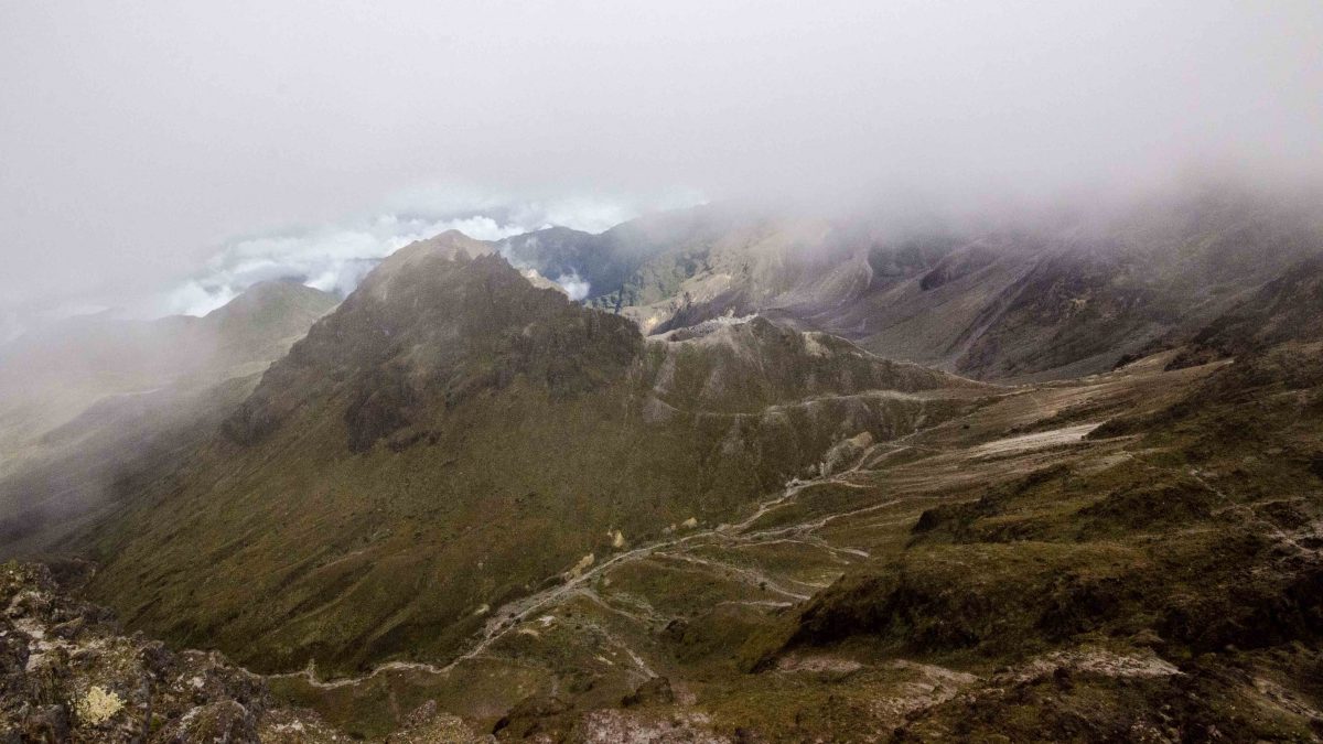
Once in the back country, you’ll discover a very different Cotopaxi National Park. This land is very much the Páramo. It is reminiscent of parts of far north Alaska or maybe even the moors of Scotland I have seen in pictures. There are huge ancient lava flows that look like river beds. There are river streams that cut into the earth and make the land look like a place from Tolkien’s Lord of the Rings. Some hills even look as if they could house Hobbits rather than ruins of an ancient people.


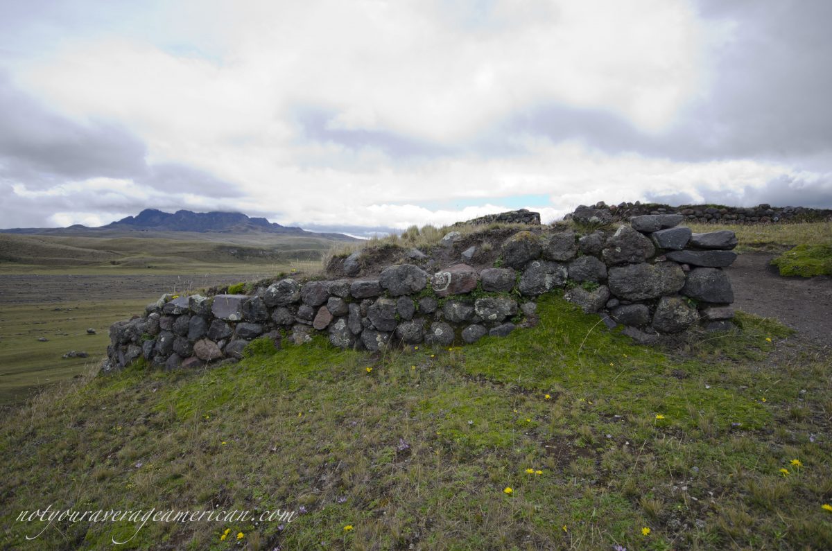
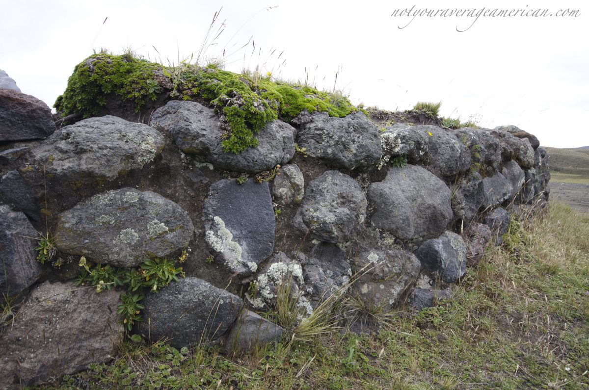
The only information on site is a small sign near the grassy parking lot with the name Pucara Salitre. Nothing else. To an untrained eye, it was easy to see that this location was chosen for its strategic value. The majority of the exposed site is built high on the hilltop to take advantage of the views all around. A small building lies lower, with less of a view, and has a partially built modern roof. We thought the entire building might be modern, an example of what the buildings might have looked like on the less preserved buildings on the hilltop, but photos online showcase this building as Incan built and as a defensive structure. Unfortunately, the ruins of the modern roof detract from the site and do little to preserve the ruins themselves.
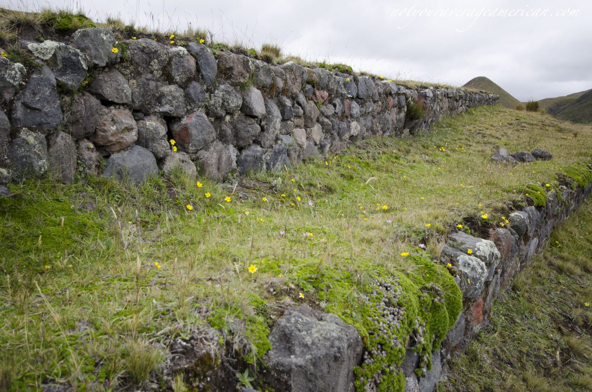
A top the hill, there are clearly two levels, one a defensive wall around the structure and the second a wall that contained many smaller buildings. Today, it seems clear that there were entrances at the north and south, though no lintels or doorways remain, only openings in the remaining low walls that are there.


We also noted many little hillocks down below. Again, my untrained eye wondered what might be under each one. Many did not look natural and I could imagine a community far more widespread than just the hilltop ruins suggest. One website mentions old llama enclosures lower on the hill, which fit the typical history of the Inca. This location could have been part of the intricate network where traveling Inca could rest on their way from Quito to the rich jungle lands of the Oriente.
History of Pucara Salitre
To learn more, I turned to the internet when I got home. I learned that the Quichua word Pucara means fort, specifically a pre-Columbian fort. Salitre is the Spanish word for saltpeter or nitrate. The vast majority of websites in both Spanish and English say that the ruins are primarily from the Inca yet no website provides academic sources:
It’s undeniable the Inca origin, at least in the majority of the building; the 70% of the archaeological material recovered has a filiation with the Inca empire, that’s why is considered it was built during the expansion of Tahuantinsuyo, at the end of the 15th century. The remaining 30 percent of the material is of local origin and is attributed to the work of the Panzaleos.
One academic paper, written in Spanish, questions whether many of the fortresses that dot the landscape of Ecuador were built by the Inca at all. The author argues that pre-Incan communities were not only capable of building stone-edifices but may have done so to protect themselves from incursions of the Incan Empire. As new Ecuadorian-trained archaeologists enter this field of study, I am sure we will learn much more. The interactions of the Inca and local indigenous communities are fraught with suppositions. There is obviously excavation to be completed across the country and as both new locations are explored and old locations are re-assessed, the history of this land will be more fully understood and appreciated.
Until that time, I am going to enjoy walking among the ancient stone walls while I imagine living in a time before Europeans stepped foot on this continent.
Please click through the gallery to see more photos:
This post was originally published before the eruption of the Cotopaxi Volcano.
While the National Park was closed for a time, it is once again re-opened and it is possible to visit most of the park.
Hikes to Laguna Limpiopungo, the Refugio, and the Incan Pucara are permitted. The Glacier and the Summit are once again open. (updated February 24, 2020)
The Refugio
From the Main Entrance, follow the main road. Head right at the intersection that heads toward Tambopaxi and the North Entrance.
From the North Entrance, follow the road in and turn left at the crossroads.
Limpiopungo
The access road to Laguna Limpiopungo is just off the main road that runs through the park. If you enter using the North Entrance, turn right on the main road as if you are headed to the Main Entrance of the park, not towards the Refugio.
Pucara Salitre
The Pucara Salitre can be found using backroads accessible from the North entrance of Cotopaxi National Park.
Information For Your Trip
Prepare for cold weather, even on beautiful days. Snow and rain can occur at any moment. Carry plenty of water and high energy snacks. Be prepared to stop hiking if anyone in your party exhibits signs of high altitude sickness.
- Direction by Car, use WAZE and look for Refugio Cotopaxi, Latacunga Canton, Pichincha; for Limpiopungo, look for Laguna de Limpios, Pichincha, Ecuador.
- Direction by Public Transportation Unfortunately, there are no great public transportation options that make it possible to arrive, hike, and depart Cotopaxi on the same day. We recommend hiring a driver and car or staying the night at a nearby lodge. Camping is prohibited while the volcano active.


Oh that first photo is amaaaaaaaaazing!
Figured the cloudy afternoon shots needed a little something to help them out!
What elevation is the Park AJ? Looks tundra like, but at the Equator? Above 10,000′ in Colorado’s San Juan Mountains we have actual tundra, an actual tundra biome at 39 N.
It is very similar to tundra in some locations. I’m not sure of the scientific designation and when I search Tundra and Cotopaxi, I get Toyota Trucks.
As to altitude:
The main entrance to the Park is at 3500 m (11,500 ft).
The Refugio, where people hike to spend the night before heading to the summit and the highest most tourists go, is at 4800m (15,748 ft).
The summit is 5,897m (19,347 ft).
I would guess most of my pictures were taken at about 4000m (13,123 ft).