
Yes, you can still come visit Ecuador!
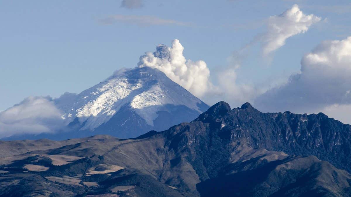
Flights are moving in and out of Quito with few problems, ash is falling in a fairly predictable pattern, and while Cotopaxi could erupt at any day, it could also wait for a year or two. Same goes for two other volcanos in country. After all, this country sits along the Ring of Fire.
Not visiting Ecuador would be like not visiting California during fire season. Most major attractions aren’t even affected by the emergency and thousands of people, from hostel owners to the employees of local restaurants to birding guides, all need to work. Granted, you will need to use some common sense. And that’s what this article is all about.

FIRST, THE UPSIDE
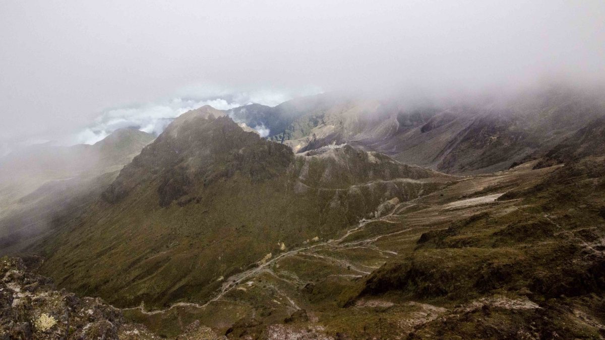
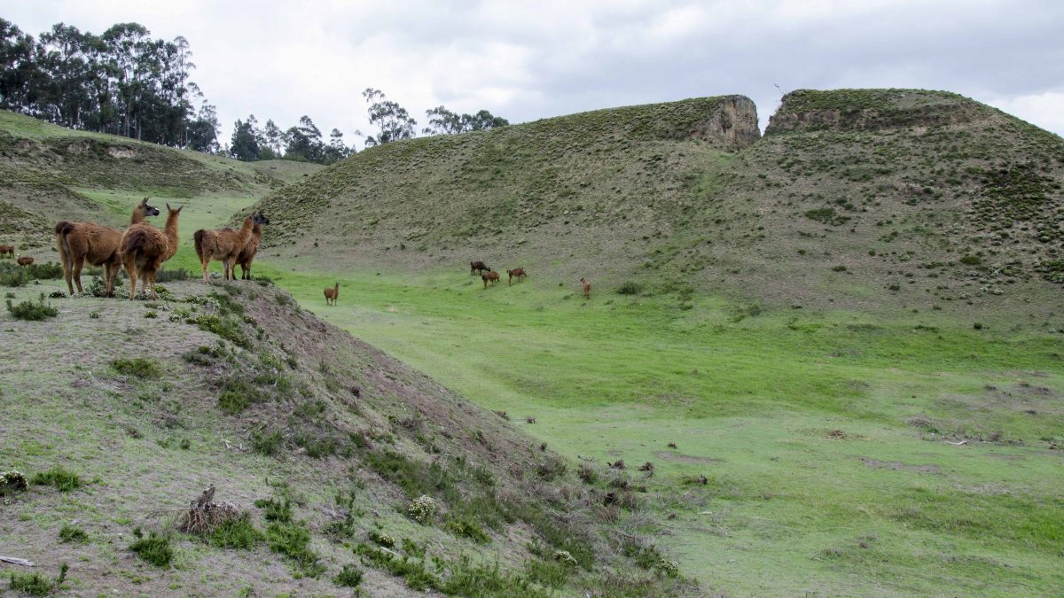
The vast majority of the tourism around Quito has been unaffected by the volcano Cotopaxi. Road travel is open to the North, to the East, and to the West. That means a large part of the Sierra, places like Otavalo with its bi-weekly market and Cotacachi with its beautiful crater lake, Cuicocha, are easily accessed. The same can be said for travel to the West, past the Mitad del Mundo and on to places like Mindo and San Miguel de los Bancos. Travel even further west, and you have the entire coast to explore. To the East, it is possible to visit the thermal springs of Papallacta, birding lodges at several different altitudes as the East Slope of the Andes rapidly drops into the Amazon Basin, on to the Oriente itself with its world famous lodges.


And if you want to travel south, there are ways to do so. Although the major highway, E-35, running from Quito down to Cuenca is experiencing ash fall, it is only along a very narrow portion of the corridor (more below in travel advisories). It is still possible to drive to E-20 going to Aloag and travel to the west before taking E-25 south at Santa Domingo. Or you could take the highway running to the east through Papallacta and hit E-45 to travel south towards Puno or Baños. Alternate routes will add hours of travel but they also offer brand new opportunities to explore parts of Ecuador that don’t often see foreign tourism. And the other option to visit locations further South is to fly direct from Quito to Cuenca or Quito to Guayaquil and travel north for further exploration.


NEXT, THE ADVISORIES
ALERT SYSTEM
We are in a yellow alert for the Volcano Cotopaxi. So let’s explain the Ecuadorian volcanic alert system.
There are four levels of alert – white, yellow, orange, and red.
- A white alert says there are no possibilities of eruption at this point in time but acknowledges that a volcano could be potentially active.
- A yellow alert signifies that a volcano is experiencing increased seismic activity and the release of ash and vapor. A yellow alert allows the government to declare a state of emergency and to prepare the local populace for an eventual eruption. Both the volcanoes Cotopaxi and Tunguraghua are on yellow alert. The latter has just seen its alert level drop from orange to yellow in the last week.
- An orange alert means that populations will be evacuated because scientists have determined that an eruption is imminent. In the case of Cotopaxi, some evacuations have already occurred near the volcano because of fears of lahar flow that are faster than most evacuations. The volcano Reventedor is on orange alert and has been so for some time.
- A red alert means that the volcano has erupted.
Most folks living locally are keeping to normal schedules during a yellow alert. The most important thing to do at this moment in time is to prepare. And tourists who are already here are treating the yellow alert as more of a nuisance than anything else. Travelers James and Rebecca MacIntyre, from Canada, told me that they had done little to change their itinerary and would only consider changing travel plans if the alert level was raised to orange. They had already traveled a large portion of the country before hearing that Cotopaxi might even be a problem.

POSSIBLE LAHAR FLOWS
Let’s face it… there are just some places you won’t be allowed to visit as well as others that we highly recommend you avoid even though they are not officially closed to tourism. Some small towns have been evacuated and Cotopaxi National Park is closed. That also means several hostels and estancias near the park are not open for business. I recently contacted a favorite hostería of ours that is located just outside the north gates of Cotopaxi National Park, Los Mortiños. The owner, Pablo Fernandez, says that all hotels and restaurants in the area have been closed since August 14 and there is no immediate plan to reopen. All depends on the volcano at this moment in time. As of this update (June, 2017) the National Park and surrounding area is open to tourism. It is not possible to summit nor to climb to the glacier though the refugio can be visited.
According to a Guide for Preventive Measures to Protect Cultural Heritage, these locations are in the most danger from a Cotopaxi eruption:

The concern is not lava flow but lahar, a deadly combination of volcanic ash, debris, and water that can come either from rain or from melting snow and ice. It can travel at tens of meters per second, making it impossible to outrun and these towns very little warning. If you must travel to these locations, stay in areas that are out of reach of potential lahar flows and please be aware of low lying areas along rivers, potential evacuation routes, and learn to recognize secure sites (sitios seguros). This map may help:

The map cannot be viewed at its source using Internet Explorer. It is best seen using Google Chrome or Firefox. Also, one of our readers is using Safari with no problems. If any other browsers are working, would you please let us know in the comments below.
The interactive map provides almost too much information. You can de-select items so that the map clears of most of the markers. This screenshot shown above includes only the potential lahar flow, evacuation zones, and the escape routes. Remember, during an emergency, escape routes can change. Please follow the instructions of emergency personnel on the ground.
FALLING VOLCANIC ASH
Travel throughout the area along the E-35 between and Ambato has been heavily affected by falling volcanic ash. That means visiting areas to the south of Quito come with a travel advisory, especially travel through Chaupi, Lasso, Mulaló y Pastocalle.

Map Source: http://www.igepn.edu.ec/images/portal/observatorios-volcanicos/volcanes/cotopaxi/VEI-1-deposito.jpg
Local expat Anna Sparks recently took family to visit the area around Quilatoa. Early Sunday morning, they found a dusting of ash on their vehicle after staying the night at the Black Sheep Inn. On their return to Quito, they encountered heavy ash fall along the route just north of Mulalo. The drive through the ash took approximately 20 minutes. The alternate route via Santa Domingo would have taken approximately 6 hours and since the authorities had not closed the road, they chose the shorter route. But Sparks was also prepared with masks for all passengers and has since taken the car in for maintenance to make sure that air filters were cleaned and that the engine was not damaged by volcanic ash. If you chose to drive these routes and drive through volcanic ash, please bring masks for each passenger and take the vehicle in for immediate maintenance upon return.
Local expat Anna Sparks recently took family to visit the area around Quilatoa. Early Sunday morning, they found a dusting of ash on their vehicle after staying the night at the Black Sheep Inn. On their return to Quito, they encountered heavy ash fall along the route just north of Mulalo. The drive through the ash took approximately 20 minutes.

The alternate route via Santa Domingo would have taken approximately 6 hours and since the authorities had not closed the road, they chose the shorter route. But Sparks was also prepared with masks for all passengers and has since taken the car in for maintenance to make sure that air filters were cleaned and that the engine was not damaged by volcanic ash. If you chose to drive these routes and drive through volcanic ash, please bring masks for each passenger and take the vehicle in for immediate maintenance upon return.
Since most tourists are not driving their own vehicles, there are other considerations. If you are renting a vehicle while in Ecuador, please confirm the details of insurance coverage with your rental company and ask specifically who is responsible for any damage to the car from driving through volcanic ash, either already on the road or actively falling. It could be an unwelcome surprise to find out that you are liable for replacing a vehicle engine at the end of your wonderful vacation.
Please take note that driving in ash is not unlike driving in snow. Roads can become slippery and visibility can be severely diminished, especially considering that using windshield wipers causes small pieces of glass from the ash to permanently scratch your windshield. All parties involved in accidents in Ecuador where a person is injured or killed will be arrested whether innocent or guilty. For more information, visit the US Embassy in Quito website.
Most tourists, however, will be traveling in these areas either with a hired driver or with a company using a bus. This too, comes with its own hazards. For example, local resident of Nayon, Maribel Quijia, visited Chimborazo this last weekend and travelled in a bus. She had no problems arriving but upon return later that evening, her bus encountered heavy ash fall in the area around Pastocalle that entered the bus itself. For this reason, we recommend to always carry your own emergency supplies, like a mask and plenty of clean drinking water. At the very least, you can always use a wet bandana tied around your nose and mouth to help prevent breathing the small particles that can do the worst damage to your throat and lungs. Equally important, be aware that consistent travel through these locations can do long term harm to engines and that each trip through volcanic ash increases the likelihood of a breakdown on the road. If you chose to travel with companies going through these areas, ask about their maintenance plans for their vehicles and their emergency plan if their vehicles break down.
If you experience ash fall, you can report it you can do so using this page.
You can also follow the twitter feed of the Secretaría Gestion de Riesgos where they have shared road closures and roads impacted by volcanic ash. Unfortunately, you may need to scroll through dozens of tweets to get the most pertinent information:
Compartimos el Informe No. 99 del @IGecuador sobre #VolcánCotopaxi. Viernes, 28 de agosto de 2015 → http://t.co/sINgWM8NP2
— Seguridad Ecuador (@Seguridad_Ec) August 28, 2015
AIR TRAVEL
The travel setback a tourist coming into Ecuador is most likely to face would be a cancelled flight. Ash in the air means that pilots have to be careful. Repeated flights through volcanic ash damage airplane engines. But the Quito airport has several approaches and makes sure flights avoid the ash from Cotopaxi rather than cancel flights altogether. Their most recent update, from August 17, 2015 is translated here:
Today, August 17, 2015, at 09:50am, the Crisis Coordination Committee of the Mariscal Sucre International Airport Quito informs the public that the airport operations remain open. According to FAA weather reports, Quito Airport is not expected to be affected by falling ash.
Passengers are recommended to contact their airline for specific information about the status of their flights.
The Crisis Coordination Committee remains active to anticipate every situation that might arise during the course of the day.
We will keep the public informed about developments.
Worse case scenario: a traveler could experience several cancelled flights in a row if Cotopaxi increases ash emissions or the winds change directions or if it erupts outright. Taking example from a volcanic eruption in in Indonesia this past July, we can guess what will happen here in Ecuador. First, it is highly unlikely that airlines will cover the extra cost of staying a few more days. However, most airlines will allow you to reschedule your flights into the country if you have not yet arrived. Second, if you are in country and trying to leave, it might be possible to claim the extra costs on your travel insurance. Before arriving, please contact your travel insurance company to confirm policy coverage of natural disasters, in general, and of volcanic activity or earthquake, specifically. This makes sense for any visit to any country along the Ring of Fire.
Just in case you’re the kind of person that wants the most up to date reports, check out the Instituto Geofísico. The official government source for information can be found at www.VolcanCotopaxi.com. Unfortunately, both sites and their published bulletins are available only in Spanish.
Finally, The Silver Lining
Ecuador is a beautiful country with diverse cultures and communities to visit. Avoiding the province of Cotopaxi means that you might discover some new places and introduce them to the rest of us. And you could potentially get some great shots of Cotopaxi in Action.


