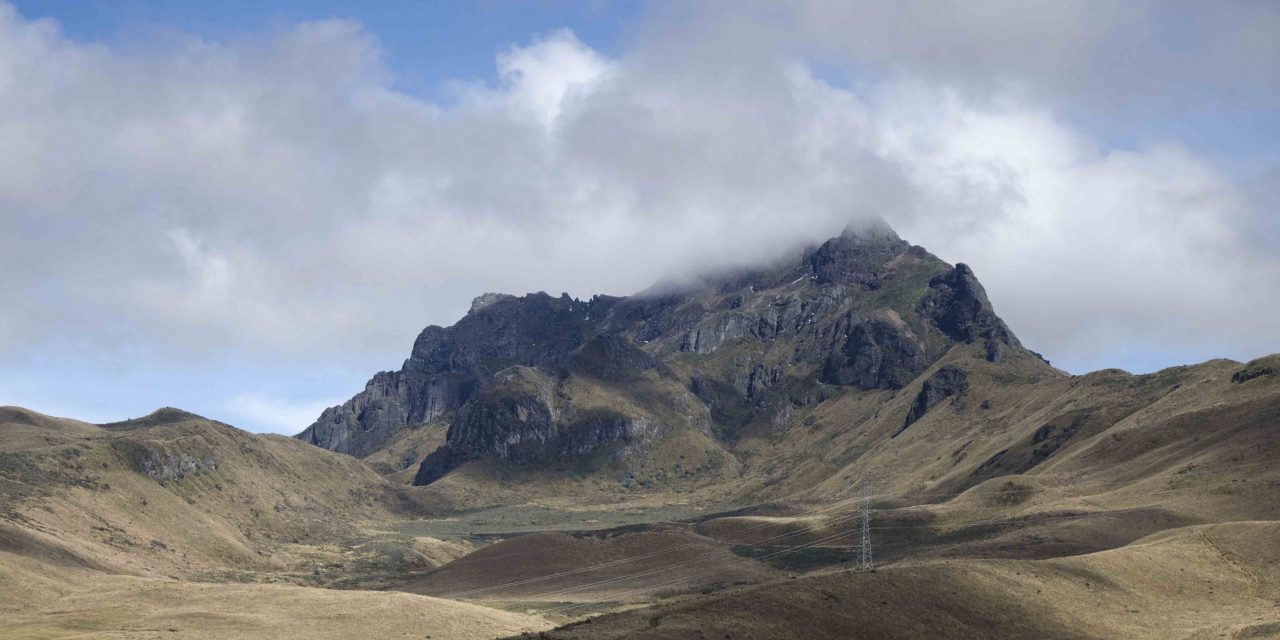
This weekend our newfound friends, a local Ecuadorian family, offered to take us on the Teleferico to hike to the top of Pichincha. That’s the volcano that erupted back in 1999. It benignly looks over the city of Quito and is most often covered by clouds in the late afternoon. Therefore, that meant an early start so we could increase our odds of seeing a view once we got to the top.
The Teleferico
For those of you who haven’t heard of the Teleferico, it’s a cable car or sky tram that takes passengers up the mountain. While it doesn’t reach the peak, it comes within a 3-hour hike of it. As of this last weekend, it cost $8.50 for a non-resident and $4.50 for a resident for a round-trip ticket.
Trust me, it’s well worth the money! On the other hand, you could choose to hike a dirt road instead. However, its hairpin turns meander up the steep mountainside and it could take you a few hours of hiking just to reach the point where we started our hike on this day. Instead, cut to the chase and hop on the sky tram!

Clear Sky = Beautiful Views
We chose a wonderful day for the adventure. The sky was clear when we arrived with clouds building up in the far distance but certainly not immediately threatening. Fortunately, we caught glimpses of both Cayambe and Cotopaxi, snow-covered volcanos near Quito.
Despite their volcanic majesty, more impressive were the views of this huge city. Two million people live here and the metropolis is very, very long. It can take upward of 2 hours to transverse Quito. Yet the city is very narrow, fitting into this high mountain valley by pushing up the sides of the mountains. Therefore, the only places left to grow are to the north and to the south.

It’s very apparent from up high that growth is still taking place. It is no longer possible to see the northern boundary even from the height of the Teleferico. On the other side, towards the south, the houses look so small that it is almost impossible to make them out in the distance.
Why Hiking From The Teleferico Is Difficult
One of the problems of hiking to the top of Pichincha from the Teleferico, especially for people coming from sea level, is the extreme altitude.
Quito is already at 9,300 ft (2,830 meters). The top of the Teleferico is at 13,451 ft (4,100 meters). The top of this peak of Pichincha is 15,413 ft (4,698 meters).
This is a good time to mention that there are two peaks. The one the Teleferico hike leads to is called Rucu (The Old One in Quichua). You can also hike to Guagua Pichincha (The Baby), from another access point. Also of note, Guagua is the active part of the volcano, with occasional closures due to volcanic gases seeping from vents.

Because Teleferico goes so high, some people experience symptoms of high altitude sickness at the top even when they feel nothing in Quito. Headache and nausea are the most common symptoms. If you feel those, it is not a good idea to hike the trails. Instead, enjoy the view for a few mintues and then head down below.
How to Manage Altitude Sickness
If you really want to hike and your symptoms are annoying rather than debilitating, try taking a remedy and waiting for an hour to see how your body adjusts.
You could try the cure sold by a couple of vendors in the Teleferico shops, coca tea. It’s an infusion made from pouring hot water over the leaves of the coca plant. Coca is a mild stimulant that is similar to caffeine. It’s often used as a common folk remedy for lack of energy and altitude sickness in Peru. While it does grow in the jungles of Ecuador, it’s use in Quito has migrated with European and American tourists to the top of Pichincha.
Local Ecuadorians are more likely to suggest chocolate as their remedy of choice. Chocolate won’t leave a residue of cocaine alkaloid in your system and might be the better choice if you’re worried about taking a drug test. Or try coca tea with a bar of chocolate!
However, your best option is to medicate BEFORE you arrive. We recommend drinking plenty of water and being hydrated in the days before hiking. Also, take the headache medicine of your choice as a preventative measure.
Finally, head down the mountain if your symptoms are not kept in check by the medication.


We were fortunate not to feel any high altitude affects immediately. We’ve been in Quito for over a month and only my husband has left for sea level since we arrived. So we were good to go and started hiking.
Hiking at High Altitude
Now, hiking at a high altitude is more difficult than hiking at sea level. Your heart can feel like you’re running a sprint even though you’re only walking up a slight incline. Your lungs fight to get every ounce of oxygen out of the thin air and you’re tempted to breathe through your mouth, taking huge gulps to compensate for what won’t come through your narrow nasal passages. The latter is a mistake as it can fill your tummy with air which only adds to the possibility of feeling nauseous later on. My advice? Take your time. You’re in no hurry to get to the top and you’re more likely to get there if you don’t push your body too far beyond its comfort zone.

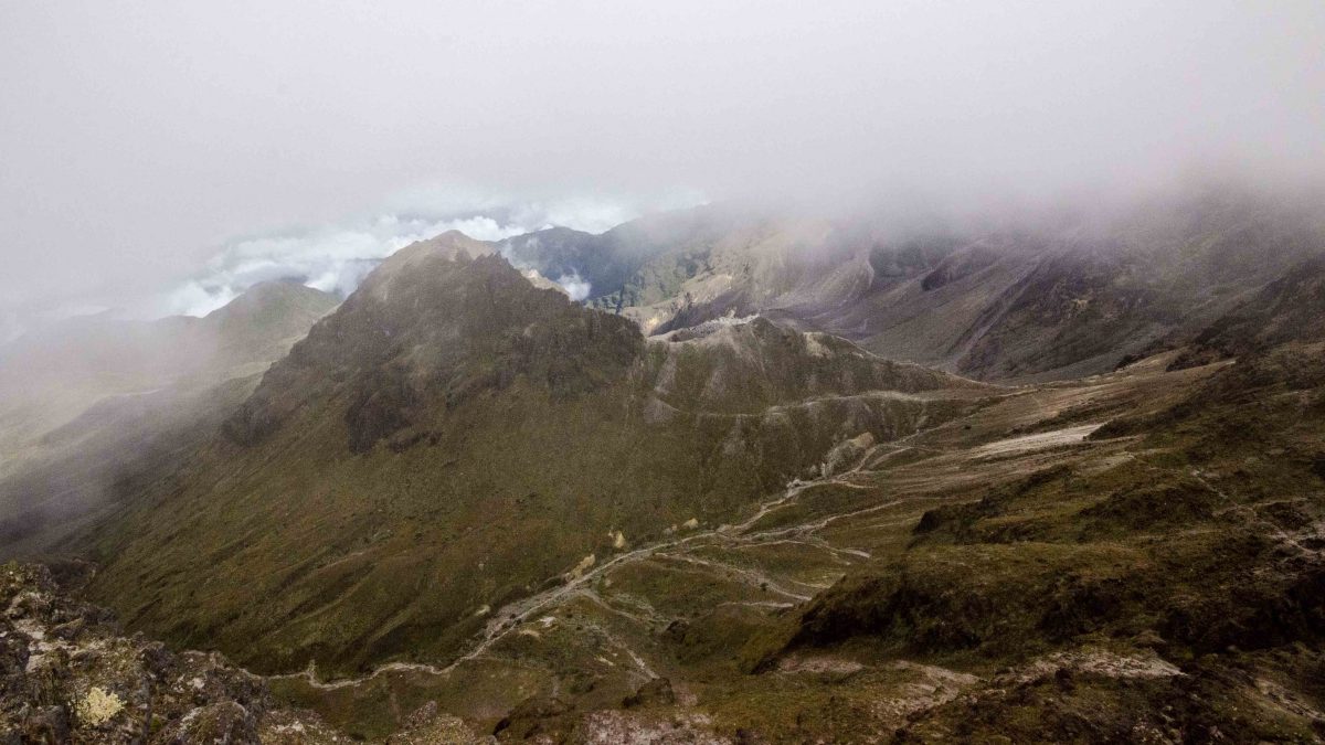
Hiking the Paramo
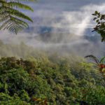
Hiking this terrain is a wonderful experience. Locals call it el paramo. The mountains are covered with tufts of golden grass, each tuft about two feet tall. There are no real trees though we did see lots of scrubby bushes. In the distance, some mountains look like they’re covered with soft, golden brown velvet. Others are dotted by small farm fields and look like patchwork quilts of greens and golds and browns.
And then there are the mountains without plants, the sheer faces of volcanic rock. Every direction in which you look provides a new view. Thus, it’s important that while you’re hiking to take the time to stop and look around. There are so many things to see.


Flowers grow very low to the ground for most of the trail. About an hour and a half in, we found orange pin cushion flowers growing on low scrubby bushes. In this same area, we watched hummingbirds flying around and could hear small songbirds singing in the distance.
It was about this beautiful spot that my husband realized he couldn’t hike anymore. The signs of altitude sickness had arrived. Unfortunately, this is where we’re going to talk about what you need to look for when your hiking partner says they don’t feel good but can still go on.


It’s Hard To Turn Back Before You Reach Your Goal
As I mentioned before, nausea and headaches can be pretty normal when hiking at high altitude. For minor symptoms, it is possible to hike. I know because I spent a long, long day on the Inca Trail in this exact condition. However, the safest route is to turn around and get the ill person back to a lower altitude as soon as possible.
This is especially the case if you or your partner start vomiting, show signs of clumsiness, or that headache becomes extreme. In my husband’s case, his body’s circulation was slowing down. Just holding his hand was a sure sign that something wasn’t right. His fingers were freezing cold and though they didn’t look swollen, they felt slightly puffy. So we headed down.

On the way back down, we took the time to smell the proverbial roses. We caught a picture of one of those gorgeous hummingbirds, purple-head, white chest, sitting proudly on the orange-flowered bushes. We followed the sounds of the songbirds but could only catch an occasional flash of dull-colored wings in the tall grass. How we relished being outdoors in a beautiful location! Despite turning back, we had a wonderful day. I only hope my husband will dare to tackle it again… but only when he hasn’t recently been at sea level!
If you plan on hiking at a high altitude any time soon, be prepared to turn around. It’s okay. Happy Hiking!
If you would like to read another trip about hiking Rucu Pichincha, check out this article: Hiking Rucu Pichincha.
The Teleferico
Entrance to the Teleferico
Information For Your Trip
Bring clothing for cold, windy and possibly wet weather. It is possible to purchase snacks and drinks up top, at premium prices. If you plan on hiking, bring high energy snacks, plenty of water, and know the symptoms of altitude sickness before starting.
For up-to-date rates, check the official website, El TeleferiQo.
- Direction by Car, use WAZE and look for Teleferico, Quito, Pichincha, Ecuador
- Direction by Public Transportation for buses around Quito, use the Google Map link and click on get directions. Use the public transportation option to find the best from your current location. The bus will not enter the Teleferico grounds and you will have to hike up to the cable car entrance.


Another adventure of a lifetime Angie! Thanks for the armchair visit. I admire your tenacity!
We are off to South Africa tomorrow. I know we will see wonderous things. Fortunately we will not have altitude issues.
Big Hugs,
Ann
I’m so excited for you! I can’t wait to see the pictures!